Coming in 2027
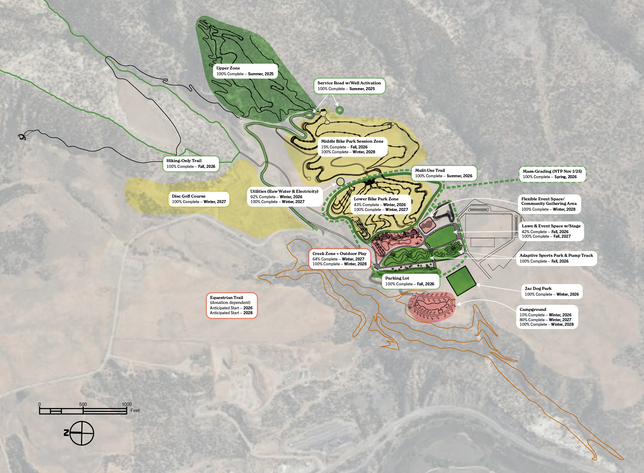
2027 will mark the park’s opening to vehicular access, with an improved access road and parking areas, supporting expanded amenities, improved accessibility, and the ability to host more events and gatherings.
-
The 1.5-acre off-leash dog park will be completed, offering a welcoming space where dogs can run, play, and socialize.
-
A gravel multi-use perimeter trail will provide a welcoming loop around the park for walking, running, and taking in the views. Designed for accessibility and ease of use, it offers a scenic way to explore the mesa and connect with other park features.
-
The flexible lawn and event space will be completed, creating an adaptable hub for events, gatherings, and community use.
-
Equestrian amenities will be developed to support the region’s strong riding and ranching heritage. Planned features as fundraising goals are met include equestrian-specific trails, arenas, and facilities designed for training and gathering, along with dedicated parking areas that can accommodate horse trailers.
-
The Lower Bike Park Skills Zone will open with beginner trails, a drop zone, and a dirt jump zone, providing riders with a fun and accessible place to build skills and confidence close to the base area.
The Middle Zone will introduce a range of new riding experiences, including a return trail, beginner downhill trail, intermediate jump trail, intermediate-plus jump trail, expert jump trail, and a dual slalom course designed for skill-building and friendly competition.
-
Development will begin on the Creek Zone, featuring a nature playground, Strider track, trials area and course, and picnic pavilions, creating a welcoming space for families, young riders, and community gathering.
-
A new 18-hole disc golf course will add another recreational opportunity to the park, offering a scenic and engaging experience for players of all skill levels.
-
Work will begin on a campground designed to welcome visitors traveling to Durango for recreation, events, and competitions, expanding opportunities to stay and experience the park.
-
Local archery groups are working to fundraise and design a regional archery range.